A citizen-led project conducted in partnership with UNSW and NSW government is using thousands of crowdsourced photos from social media to monitor the changes to coastlines caused by storms and extreme weather events.
CoastSnap is a program which uses a number of basic camera mounts at beaches which the public can use to take a photo and upload it on the CoastSnap app or to social media, using the hashtag #CoastSnap.
To show the value of citizens contributions to enivonrmental research, Dr Mitchell Harley, coastal expert showcased a time-lapse of CoastSnap images, showing changes in beach width.
“Incredible what can be done with a piece of stainless steel & an active community!” he said.
Introducing new #CoastSnap product, showing time-series of beach width change from your community snaps. Check out an entire year of change at our North Narrabeen station. Incredible what can be done with a piece of stainless steel & an active community! #citizenscience pic.twitter.com/EWcHKwD3P8
— Mitchell Harley (@DocHarleyMD) March 1, 2021
Dr Harley, who is from UNSW’s School of Civil and Environmental Engineering, led a new study published in the Journal of Coastal Engineering has found the program is as accurate as shoreline monitoring equipment.
The study researchers used the images to help them analyse why some coastlines change more drastically than others.
Dr Harley said scientists have previously had to rely on expensive equipment or hand-collected data through intensive fieldwork.
Dr Harley said CoastSnap was the data collection method used at two beaches in Sydney over a 7-month period, he found “that the shoreline data obtained from this community-based technology was comparable in accuracy to that collected by professional shoreline monitoring equipment”.
The researchers found over the last year “we had a whole series of extreme storm events – some of the most intense we’ve seen over the last 30 to 40 years”, Dr Harley said.
It was a general consensus there will be less storms, but they will be more intense.
Dr Harley hopes the data collection will improve planning for coastal communities where many houses are built along the coastal edge.
“We need to ensure our coastal communities are planned properly, and effectively, to avoid repeating the mistakes of the past,” he said.
Dr Harley and her team aim for CoastSnap to expand within the next few years. They are hoping to see it included in secondary school curriculums, as well as surf lifesaving to “learn more about rip currents” and coastline hazards.
They also would like for users to be able to access real time visual changes to coastlines at any location, all through the app.
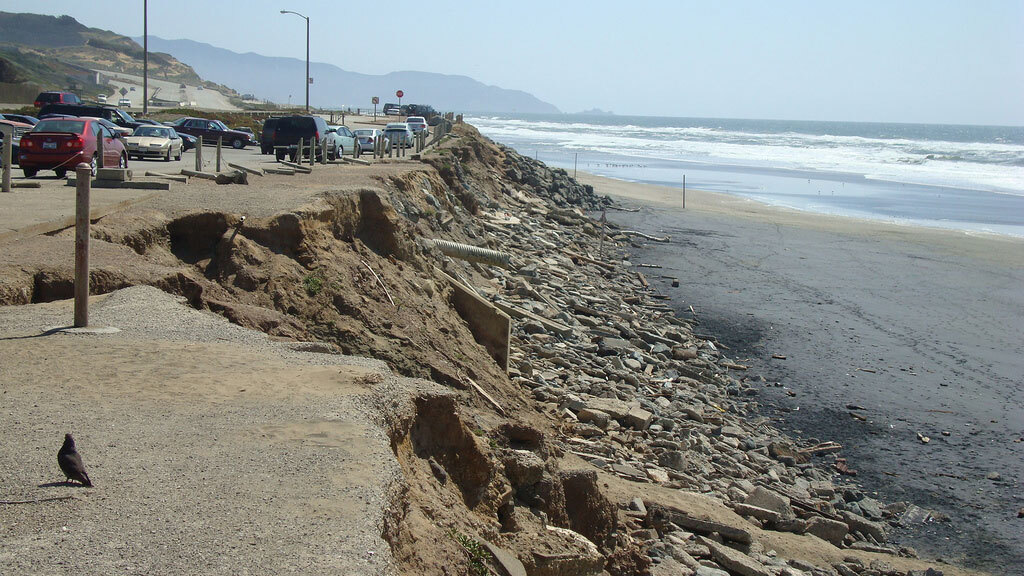
Photo: Ocean Beach Erosions by Coastal Care available HERE https://commons.wikimedia.org/wiki/File:Coastal_Erosion.jpg and used under a Creative Commons Attribution. The image has not been modified.